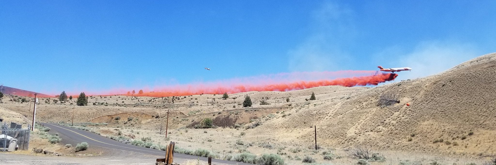
REDMOND, Ore. – Active suppression work is continuing on the southwest corner of the fire and around the finger to the north, while patrolling, chipping and backhauling – the gathering up of miles of hose and other tools used to combat the fire – is taking place along large sections of the fire perimeter.
In other work, the roads group cleared a mile or more of the Hwy. 46 corridor Thursday and will continue work today.
Aviation continued to coordinate non-fire flights for fire-related purposes, including a survey of Rocky Mountain goats on Mt. Hood. The Civil Air Patrol finished grid mapping for the Federal Emergency Management Agency.
A previously inactive spot fire located about 10 miles northwest of Breitenbush Hot Springs, within the 2011 Motherlode Fire burn scar, flared up in recent days and has spread to 25 acres. Helicopters dropped water Wednesday and Thursday to slow its progression. Lionshead and Beachie Creek fire managers are monitoring the situation closely and have established a series of trigger points for escalating the response if needed.
Yesterday, Oregon Department of Transportation added an additional pilot car to the Santiam Canyon schedule. The new pilot car schedule for Hwy. 22 is: Detroit to Gates at 7:30 a.m.; Gates to Detroit at 9 a.m.; Detroit to Gates at 11 a.m.; Gates to Detroit at 1 p.m.; Detroit to Gates at 5 p.m.; and Gates to Detroit at 6 p.m.
The road block on Hwy. 22 has been moved to milepoint 46.7 to open access to bathroom and other facilities at Mongold State Park. This area will be used to stage vehicles waiting for the pilot car.
Today, the Willamette National Forest lifted public restrictions on campfires due to increased moisture and cooler temperatures. Personal firewood cutting may resume, but chainsaw use is not allowed from 1 p.m. to 8 p.m., and must be followed by a one-hour fire watch after equipment is shutdown. The Sept. 25 closure order is still in effect. A list of recreation areas within the fire zone that remain closed can be found at https://go.usa.gov/xGpeV
Weather & Fuel Conditions: Most of Thursday’s smoke haze was from the California fires, although there was active burning deep within the perimeter of the northeast corner again. Temperatures will drop slightly today, into the high 70s to low 80s, with light winds continuing.
Evacuations and Closures: Breitenbush Hot Springs remains at Level 3 – “Go!” Detroit, Idanha, Hwy. 22 east of Detroit Dam to milepost 56, and Opal Creek Wilderness/Jawbone Flats are at Level 2 – “Be Set.” Elkhorn, Gates east of Gates Hill Road, and Hwy. 22 from Gates Hill Road east to Detroit Dam are at Level 1 – “Ready.”
Residents of Linn County can find up to date information at www.LinnSheriff.org. All closures on federal lands remain in effect. This includes a 40-mile section of the Pacific Crest Trail between Santiam Pass and Olallie Lake. Closure orders and maps can be found at https://inciweb.nwcg.gov/incident/7049/
Lionshead Fire
Pacific Northwest IMT #13
Public Information Phone: 971-277-5075
Media Inquiries: 541-904-0542
Incident E-mail: [email protected]
Incident Website: https://inciweb.nwcg.gov/incident/7049
YouTube: https://www.youtube.com/channel/UCHSR6_yJRQkHyGjvvqX99gw
Facebook: www.facebook.com/LionsheadFire


